Yorkshire Mine, Tarnagulla, 2014
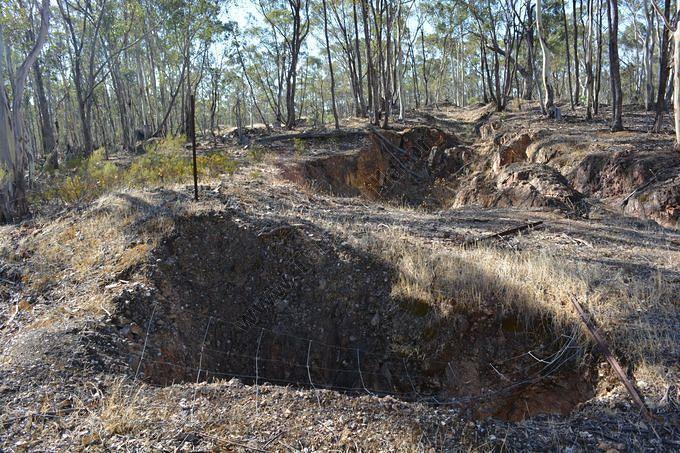
This photograph is looking to the north, about 100 metres south of the main Yorkshire shaft. The collapsed shaft in the foreground is the Yorkshire's sand shaft which was used to lower mullock into the underground workings to fill the voids following extraction of the ore. This shaft is almost 500 feet deep.
The open cutting behind the shaft is the original reef outcrop of Watt's Reef, and dates from early 1858 when John Watt discovered the reef. Quartz from this cutting was very rich, averaging six ounces of gold per ton.
GPS Coordinates:
S. 36 44'45.80"
E. 143 50'11.19"
David Gordon Collection.
The open cutting behind the shaft is the original reef outcrop of Watt's Reef, and dates from early 1858 when John Watt discovered the reef. Quartz from this cutting was very rich, averaging six ounces of gold per ton.
GPS Coordinates:
S. 36 44'45.80"
E. 143 50'11.19"
David Gordon Collection.